

About
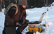
Zonge International is a geophysical services and equipment resource for geoscientists and project managers in exploration, research, geotechnical and environmental engineering worldwide. Zonge is a resource to exploration managers, geotechnical engineers, and independent consultants meeting client-company geophysics needs in three application arenas: exploration, environmental and geotechnical.
Looking for geophysical survey equipment for TDEM, MT, CSAMT, IP or other EM methods with proven performance and adaptability to your targets and objectives? Zonge has it. Zonge data acquisition systems, instruments and software are customizable and extensively field tested, designed and built from over 40 years of research by the company that pioneered the use of EM geophysical methods for both deep and near-surface investigations. Zonge survey equipment is the best investment for the professional contractor wanting maximum-use flexibility as well as the project consultant wanting a reliable solution for in-house needs.
Exploration Geophysical Services
• Faster, more strategic surveys
• 32-bit highest-quality MT data possible
• Wireless EM and wireless seismic arrays
• High-resolution, 3D data acquisition
• Acquisition, joint interpretation of EM, seismic, CSAMT, gravity, magnetics
• Rock properties laboratory testing
• Data and support for independent consultants to complete geophysics program management
• Ground and shallow-water geophysical field services
• Acquisition, processing, modeling and integrated interpretation of geophysical data — all or any part of the process
• Worldwide deployment
Engineering Geophysics Services
• Urban infrastructure, construction hazard and engineering design input: depth to bedrock, elastic properties, hazard discovery, site classification
• Non-intrusive methods for determining the integrity of dams, levees, bridges, mine tailings and impoundment structures
• Geophysics for wind-turbine generator foundation design
• Groundwater exploration and resource management geophysics
• AMT/CSAMT surveys for mining and groundwater applications
• Time-lapse monitoring of contaminant migration, mine sites, CO2 sequestration, levee seepage and other hazards
• UXO detection and discrimination