
Products & Services
See also: Categories | Featured Products | Technical Articles | More Information-
Supplier: Accuris
Description: The role of differential GPS networks in timing applications
-
Supplier: Accuris
Description: TECHNICAL CHARACTERISTICS OF GPS DIFFERENTIAL TRANSMISSIONS FROM MARITIME RADIOBEACONS
-
Supplier: Accuris
Description: Technical characteristics of GPS differential transmissions from maritime radiobeacons
-
-
Supplier: Richardson RFPD
Description: the timing error under clear skies to less than 5 ns without the need for an external GNSS correction service. To further improve accuracy locally, the ZED-F9T features differential timing modes that exchange correction data with other neighboring GNSS timing receivers via a communication
- Supply Voltage: 1.8 V
- Technology: GPS
- Device Type: Receiver
-
Supplier: SBG Systems SAS
Description: Ekinox-N is an ITAR Free Inertial Navigation System with integrated GPS + GLONASS receiver. It combines an Inertial Measurement Unit (IMU), runs an enhanced on-board Extended Kalman Filter (EKF) which fuses in real-time inertial data with internal GPS information. High performance for
- Angular Rate Range: 400.0000000000002 deg/sec
- Bandwidth: 100 Hz
- Linear Acceleration Range: 5 g
- Accuracy: 0.05 ±% Full Scale
-
Supplier: Shenzhen Rion Technology Co., Ltd
Description: company in satellite navigation measurement. By GPS L1, L2, Beidou B1, B3 signals and heading algorithm, it precisely figure out antenna position value and the included angle between two antenna phase position center tie line and true north. When positioning, it could receive
-
Supplier: Northrop Grumman Corporation
Description: developed from the latest, proven fiber-optic technology and weighs less than 26 lb (11.79 kg). The LN-260 is equipped with three independent navigation solutions: blended INS/GPS, INS only and GPS only. Our INS/GPS solution provides more accurate velocity measurements, superior
- Operating Temperature: -40 to 159.8 F
-
Supplier: Northrop Grumman Corporation
Description: The LN-100G is a versatile Inertial Navigation System/Global Positioning System (INS/GPS) capable of performing high-accuracy navigation while supplying unsurpassed sensor stability for superior geo-location needs. The LN-100G is a non-dithered 0.8 nm/hr free INS/GPS utilizing the
- Angular Rate Range: 400.0000000000002 deg/sec
- Linear Acceleration Range: 16 g
- Operating Temperature: -65.2 to 159.8 F
-
Supplier: Eteily Technologies India Pvt. Ltd.
Description: GPS/GLONASS/Galileo L2 Band Passive Ceramic Antenna in Russia The GPS/GLONASS/Galileo L2 Band SMD Passive Ceramic Antenna (25x25x2 mm) is engineered for high-precision satellite positioning, supporting the L2 frequency band across multiple global navigation systems. Its compact
- Primary Frequency Range: 1,575.42 MHz
- Gain: 1.5 dB
- Operating Temperature: -40 to 185 F
- Applications: GPS
-
Supplier: Eteily Technologies India Pvt. Ltd.
Description: GPS/GLONASS/GALILEO/IRNSS L1/L2/L5 Passive Ceramic Patch Antenna 25*25*2mm The GPS/GLONASS/Galileo L1/L2/L5 Band SMD Passive Ceramic Antenna (25x25x2 mm) is engineered for high-precision satellite positioning, supporting the L2 frequency band across multiple global navigation systems.
- Primary Frequency Range: 1,575.42 MHz
- Gain: 3.34 dB
- Operating Temperature: -40 to 185 F
- Applications: GPS
-
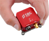
Supplier: SBG Systems SAS
Description: miniature inertial navigation sensor. It embeds the latest generation of GNSS receivers (GPS/GLONASS/BEIDOU/GALILEO) for a better satellite availability in harsh GPS environments (i.e urban canyons). In addition to provide accurate position and velocity, the GPS aiding allows
- Angular Rate Range: 450 to 1,000.000000000002 deg/sec
- Bandwidth: 133 Hz
- Linear Acceleration Range: 8 to 16 g
- Accuracy: 0.2 ±% Full Scale
-
Supplier: SBG Systems SAS
Description: Magnetometer Velocity: Odometer, DVL Internal Dual Antenna GPS for a More Robust Heading Ekinox-D is a Survey Grade INS/GNSS solution. It embeds a Dual L1/L2 GPS + GLONASS receiver to provide robust and accurate true heading. For further performance, it can be connected to up to 4
- Angular Rate Range: 400.0000000000002 deg/sec
- Bandwidth: 100 Hz
- Linear Acceleration Range: 5 g
- Accuracy: 0.05 ±% Full Scale
-
Supplier: SBG Systems SAS
Description: (option) Key Features: Very Low Noise Gyroscopes Survey-Grade L1/L2 GNSS Receiver Differential Corrections (RTCM) Connection to Odometer 200 Hz Output Rate Post-processing capabilities Internal Survey-grade Dual-antenna GNSS Receiver for Accurate Position and Heading Ellipse-D has been
- Angular Rate Range: 450 to 1,000.000000000002 deg/sec
- Bandwidth: 133 Hz
- Linear Acceleration Range: 8 to 16 g
- Accuracy: 0.2 ±% Full Scale
-
Supplier: Broadcom Inc.
Description: The Avago ALM-GA001 is a low noise amplifier (LNA) designed for GPS/ISM/WiMAX applications. The LNA uses Avago's proprietary GaAs enhancement-mode pHEMT process to achieve high gain with very low noise figure and high linearity.
- Frequency Range: 1,565 to 1,606 MHz
- Minimum Gain: 13 to 15 dB
- Maximum Gain: 18 to 19 dB
- Noise Figure: 0.97 dB
-
Supplier: DigiKey
Description: RF IC VCO GPS 70MHz ~ 150MHz Differential Output SOT-6
-
Supplier: Eteily Technologies India Pvt. Ltd.
Description: efficient in signal reception. ✅ SMD (Surface-Mount) Design: Space-efficient, perfect for integration into compact devices. ✅ Small Form Factor: Dimensions of 25x25x2 mm, ideal for embedded applications. ✅ L5 Band Compatibility: Suitable for high-precision and differential GPS
- Primary Frequency Range: 1,575.42 MHz
- Gain: 3.3 dB
- Operating Temperature: -40 to 185 F
- Applications: GPS
-
Supplier: Eteily Technologies India Pvt. Ltd.
Description: efficient in signal reception. ✅ SMD (Surface-Mount) Design: Space-efficient, perfect for integration into compact devices. ✅ Small Form Factor: Dimensions of 25x25x2 mm, ideal for embedded applications. ✅ L5 Band Compatibility: Suitable for high-precision and differential GPS
- Primary Frequency Range: 1,575.42 MHz
- Gain: 2.6 dB
- Operating Temperature: -40 to 185 F
- Applications: GPS
-
Description: Land and Aerial Surveying Clean Harbors' methods of line layout and surveying in forested areas take advantage of GPS for positioning on all aspects of a land and aerial surveying project. With the use of GPS technology, we preprogram positional data; and with the use of
- Industry: Agricultural / Forestry, Environment, Metals and Mining, Petroleum / Oil & Gas, Utilities
- Features: Canada Only, Midwest US Only, North America, Northeast US Only, Northwest US Only, Other, Southern US Only, Southwest US Only, United States Only
- Services: Planimetric Surveys, Topographic Surveys
-
Supplier: SAE International
Description: The CDR reported speed values were compared to Racelogic VBox differential GPS speed records. Data recorders were also used to monitor the vehicle Controller Area Network (CAN) bus traffic, including the indicated speed, brake pressure, engine RPM, and accelerator pedal position. The
-
Supplier: Microchip Technology, Inc.
Description: The ZL30159 single PLL rate converter is part of Microchip's ClockCenter platform and can synchronize to any clock rate from 1 Hz (1pps) to 750 MHz. The conversion from 1pps is especially useful for GPS clock generation to 25MHz or 156.25MHz. The ZL30159 includes a high precision synthesizer
-
Supplier: SAE International
Description: Crash Data Retrieval system. A Racelogic VBOX SL3 20 Hz differential GPS speed data recorder also served as a data acquisition system for vehicle CAN bus speed, accelerator position, RPM, and brake tape switch data. Graphs of RCM speed/brake/accel pedal data versus VBOX speed and other
-
Supplier: Silicon Labs
Description: devices are ideal for general purpose clock distribution of differential and single-ended signal formats. The SL18860 TCXO fanout buffer is used to replicate the RF output of the TCXO used in handheld applications like smart phones, GPS navigation devices and tablet computers. Low
- Number of Transmitters: 8 #
- Number of Receivers: 1 #
- TJ: -40 to 85 C
- Pin Count: 24 #
-
Supplier: H.O. Penn Machinery Company, Inc.
Description: advanced electro-hydraulic controls which have been designed and tuned to achieve maximum productivity and performance when equipped with AccuGrade GPS, ATS or Laser Grade Control Systems. Differential Steering Maintain power to both tracks while turning. Tiller Bar Control System A
- Operating Weight: 36,670 lbs
- Features: Other
-
Supplier: SAE International
Description: We studied the effect of steering dynamics on lateral dynamics for a 1.6 ton 4x4 sport utility vehicle (SUV) on deformable surfaces. The vehicle used for the outdoor tests was equipped with (1) a steering robot to apply repeatable steering wheel excitations and (2) a high-precision
-
Supplier: SAE International
Description: The tailpipe exhaust emissions were measured using a EURO4 emissions compliant SI car equipped with on-board measurement systems such as a FTIR system for gaseous emission, a differential GPS for velocity, altitude and position, thermal couples for temperatures, and a MAX fuel meter
-
Supplier: Shenzhen Milvent Technology Co., Limited
Description: therefore it prolongs seal gaskets service life and improve the reliability of the device. Application: Lighting, Solar, Telecom, Automotive,Agriculture. WIFI GPS. Outdoor Enclosure etc. Performance: · Pressure equalization and release in order to extend seal life · Prevent condensation ·
- Features: Other
-
Supplier: Microchip Technology, Inc.
Description: Configurable port mapping and disable sequencing PortSwap Configurable differential intra-pair signal swapping Configurable differential intra-pair signal swapping PHYBoost Programmable USB receiver sensitivity USB Link Power Management (LPM) support Vendor Specific Messaging (VSM)
- Features: Serial Hub
-
Supplier: Microchip Technology, Inc.
Description: system latency to meet 4G LTE, 5G & Wireless Infrastructure Ultra-fast lock to GPS/GNSS and 1PPS for faster power-up time for 4G LTE, 5G & Wireless Infrastructure Precise chip-to-chip time interfaces use less backplane traces for 1PPS distribution for chassis systems Split oscillator option
-
Supplier: Microchip Technology, Inc.
Description: and software platform including IEEE 1588-2008 Precision Time Protocol Stack and Synchronization Algorithms. Additional Features One independent clock channel Precise phase/frequency measurement and tuning lower system latency to meet 4G LTE, 5G & Wireless Infrastructure Ultra-fast lock to
-
Supplier: CAS DataLoggers
Description: Delphin LogMessage LM5000 Data Logger devices are specifically designed as universal data loggers. Product Highlights Reliable data logger including potential isolation 16 Universal analog inputs for thermocouples, RTDs, mV or mA signals High-precision differential inputs with up to 24-bit
- Analog Input Channels: 16 #
- Sampling Frequency: 0.08 kHz
- Resolution: 24 bits
- Data Storage: 15,500 MB


















Find Suppliers by Category Top
Featured Products Top
-
 Jitter (12KHz~20MHz): 0.1 pSec @ 155MHz Operating Temperature: -20°C ~ +70°C -40°C ~ +85°C -40°C ~ +125°C Applications Network adapter cards, Test Instrumentation 40Gbit/100Gbit Ethernet, MAN, SONET, Fiber Channel Portable Multimedia Devices, Hard Disk Drives GPS/Navigation, Bluetooth, 802.11a/b/g WiFi (read more)
Browse Oscillators Datasheets for Interquip Electronics Co., Ltd. -
Key Features and Benefits: Frequency: 312.5MHz LVDS/LVPECL/HCSL Differential output Phase Jitter (12KHz~20MHz): 42fs @ 312.5MHz LVDS/HCSL Output 38fs @ 312.5MHz LVPECL Output Low Power Consumption: Operates at supply voltages (read more)
Browse Oscillators Datasheets for Interquip Electronics Co., Ltd.
Conduct Research Top
-
PREFACE TO THE SECOND EDITION
the following: New signal structures for GPS, GLONASS, and Galileo. New developments in augmentation systems for satellite navigation, including. (a) Wide-area differential GPS (WADGPS). (b) Local-area differential GPS (LADGPS). (c) Space-based augmentation systems (SBASs) (d) Ground-based
-
INS600 RTK INTEGRATED NAVIGATION SYSTEM
? INTRODUCTION The INS600 series is a dual-antenna GPS/INS integrated navigation system built by RION. The dual-antenna differential positioning measurement unit (IMU) is precisely calibrated in the full temperature to meet the performance requirements in different environments. The multi-data
More Information Top
 Indicates content that may require registration and/or purchase.

-
Distributed Space Missions for Earth System Monitoring
His research activities deal with monostatic and bistatic synthetic aperture radar for remote sensing and surveillance and relative navigation of spaceborne, airborne and ground-moving platforms by carrier-based differential GPS .
-
Global Positioning Systems Inertial Navigation and Integration 2nd Edition
1.3.1 Differential GPS (DGPS), 7 .
-
Avionics Navigation Systems 2nd Edition Complete Document
… 207 5.5.5 GPS Signal Structure 213 5.5.6 The GPS Navigation Message 218 5.5.7 GPS Measurements and the Navigation Solution 226 5.5.8 Aviation Receiver Characteristics 229 5.5.9 Differential GPS 248 5.5.10 …
-
Optoelectronics Engineering and Information Technologies in Industry
Keywords:Kalman filter, carrier-phase differential GPS , GPS/INS integrated navigation, high .
-
Characterization of between-receiver GPS-Galileo inter-system biases and their effect on mixed ambiguity resolution
dGE 2;j À dGE 1;j , denoting the between-receiver differential GPS -Galileo inter-system biases (ISB) for, respectively, phase and code.
-
GPS
Methods such as the zero-, single-, double-, triple-, and user defined differential GPS data processing are unified in a unique algorithm.
-
http://dspace.mit.edu/bitstream/handle/1721.1/49943/33887459-MIT.pdf?sequence=2
ErrorModeling for Differential GPS .
-
Global Positioning System: Theory and Applications, Volume I > Table Of Contents
510 Differential GPS Positioning ........................................................................................