
-
Supplier: CSA Group
Description: applicable to tribrachs which are used for levels, theodolites, tacheometers, GPS equipment, EDM instruments and in combination with targets, reflectors, antennae etc.
-
Description: applicable to tribrachs which are used for levels, theodolites, tacheometers, GPS equipment, EDM instruments and in combination with targets, reflectors, antennae etc.
-
Description: ISO 17123-5:2012 specifies field procedures to be adopted when determining and evaluating the precision (repeatability) of coordinate measurement of total stations and their ancillary equipment when used in building and surveying measurements. These field procedures have been developed
-
-
Supplier: CSA Group
Description: ISO 17123-5:2018 specifies field procedures to be adopted when determining and evaluating the precision (repeatability) of coordinate measurement of total stations and their ancillary equipment when used in building and surveying measurements. Primarily, these tests are intended to be field
-
Description: ISO 17123-7:2005 specifies field procedures to be adopted when determining and evaluating the precision (repeatability) of optical plumbing instruments and their ancillary equipment, when used in building and surveying measurements. ISO 17123-7:2005 is not applicable to optical plummets as a
-
Supplier: CSA Group
Description: ISO 17123-7:2005 specifies field procedures to be adopted when determining and evaluating the precision (repeatability) of optical plumbing instruments and their ancillary equipment, when used in building and surveying measurements. ISO 17123-7:2005 is not applicable to optical plummets as a
-
Supplier: CSA Group
Description: ISO 17123-6:2012 specifies field procedures to be adopted when determining and evaluating the precision (repeatability) of rotating lasers and their ancillary equipment when used in building and surveying measurements for levelling tasks. Primarily, these tests are intended to be field
-
Description: ISO 17123-6:2012 specifies field procedures to be adopted when determining and evaluating the precision (repeatability) of rotating lasers and their ancillary equipment when used in building and surveying measurements for levelling tasks. Primarily, these tests are intended to be field
-
Supplier: Eteily Technologies India Pvt. Ltd.
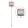
Description: 1.13 mm coaxial cable, 10 cm in length ✅ U.FL (IPEX) connector for compact integration Applications: High-precision GNSS systems UAVs, drones, and autonomous vehicles Geodetic and surveying equipment Advanced asset tracking solutions IoT and M2M applications with GNSS needs Timing and
- Primary Frequency Range: 1,575.42 to 1,602 MHz
- Gain: 3.25 dB
- VSWR: 2 :1
- Operating Temperature: -40 to 185 F
-
Supplier: Eteily Technologies India Pvt. Ltd.
Description: and geodetic systems. Autonomous Vehicles and Drones: Provides precise location data for autonomous navigation and flight control. Fleet and Asset Tracking: Used in tracking systems for vehicles, assets, and personnel. Precision Agriculture: Integrated into agricultural equipment for
- Primary Frequency Range: 1,575.42 MHz
- Gain: 3.34 dB
- Operating Temperature: -40 to 185 F
- Applications: GPS
-
Supplier: ASTM International
Description: 1.1 This test method covers procedures concerning site preparation, technical procedures, quality control, and equipment to direct the efforts for determining volumes of bulk material. These procedures include practical and accepted methods of volumetric determination. 1.2 This test method
-
Description: limited to, the following: abstract concepts (e.g., absolute latitude accuracy, geodetic azimuth); airborne particulates and aerosols (e.g., cloud, dust, fog, snow); animals (e.g., civilian, fish, human, whale pod); atmosphere and atmospheric conditions (e.g., air temperature, humidity, rain





Find Suppliers by Category Top
Conduct Research Top
-
Ocean Bottom Tiltmeters for Geophysical Research
The Carnegie Institution of Washington has installed two Jewell Instruments Model 510 Geodetic Borehole Tiltmeters in the sea floor east of Japan. The scientists are attempting to establish long-term sea floor observatories in one of the world's most active earthquake zones. Each observatory
More Information Top
 Indicates content that may require registration and/or purchase.

-
IAG 150 Years
…2010, the International GNSS Service (IGS) (Dow et al. 2009) started the MGEX campaign (Rizos et al. 2013), in order to provide the scientific community with tracking data for the new GNSS signals and systems, using state-of-the art geodetic equipment .
-
Geodesy for Planet Earth
A two-frequency geodetic equipment (Leica GPS1200 receiver, Leica Choke Ring antenna (AT504), see Fig. 92.6, left) was used as reference antenna.
-
Set of Standards and Measuring Instruments for Testing the Equipment of Users of the GLONASS and GPS Satellite-Based Navigation Systems
Key words: satellite-based geodetic equipment , satellite-based navigation equipment, measuring instrument, signal simulator, velocity measuring system.
-
Terrestrial monitoring of a radio telescope reference point using comprehensive uncertainty budgeting
geodetic equipment need to be known with high accuracy.
-
The results of gravity surveys at geophysical grounds in the Kaluga region
…30 m in depth have been drilled in the surveyed area, including a 300 meter deep well drilled with coring (Bobachev and Erokhin, 2010); • Besides, all students involved at the measure ments with the modern geodetic equipment , which is necessary for…
-
Automated lasting monitoring of building deformations and detection of static sizes on the example the Zwickauer dome
So far, the classical outweighed thereby simple methods like gypsum marks, plummets or the insert of classical geodetic devices .
-
Geodetic Control of Structures of the Bratsk Hydropower Plant
Practice shows that long-term preservation of the geodetic equipment is an important advantage of geodetic control of the structures of the Bratsk HPP and other hydro- power plants.
-
Metrological Support to Geodesy in Geological and Geophysical Research
Information is given on a metrological test area for certifying satellite geodetic equipment .
-
ARTILLERY BATTALION SYSTEM
The vehicle is also outfitted with reconnaissance and observation equipment (such as laser rangefinders), topographic‐ geodetic equipment and communications equipment.