MATLAB Recipes for Earth Sciences
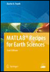
Introducing methods of data analysis in geosciences using MATLAB, this book includes a brief description of each method and numerous examples demonstrating how MATLAB can be used on data sets from earth sciences.
 TABLE OF CONTENTS
 The Shuttle Radar Topography Mission (SRTM) incorporates a radar system that flew onboard the Space Shuttle Endeavour during an 11-day mission in February 2000. SRTM is an international project spearheaded by the National Geospatial-Intelligence Agency (NGA) and the National Aeronautics and Space Administration (NASA). Detailed info on the SRTM project including a gallery of images and a users forum can be accessed on the NASA web page:
http://www.2.jpl.nasa.gov/srtm/
The data were processed at the Jet Propulsion Laboratory. They are being distributed through the United States Geological Survey s (USGS) EROS Data Center by using the USGS Seamless Data Distribution System.
http://www.seamless.usgs.gov/
Alternatively, the raw data files can be downloaded via FTP from
ftp://e0mss21u.ecs.nasa.gov/srtm/
This directory contains zipped files of SRTM-3 DEM's from various areas of the world, processed by the SRTM global processor and sampled at 3 arc seconds or 90 meters. As an example, we download the 1.7 MB large file s01e036.hgt.zip containing the SRTM data. All elevations are in meters referenced to the WGS84 EGM96 geoid as documented at
http://www.earth-info.nga.mil/GandG/wgs84/index.htm
The name of this file refers to the longitude and latitude of the lower-left (southwest) pixel of the tile, i.e., one degree southern latitude and 36 degrees eastern longitude. SRTM-3 data contain 1201 lines and 1201 samples with similar overlapping rows and columns. After having downloaded and unzipped the file, we save s01e036.hgt in our working directory. The digital elevation model is provided as...