10.2 GPS for Forestry and Natural Resource
GPS has been applied successfully in many areas of the forest industry. Typical applications include fire prevention and control, harvesting operations, insect infestation, boundary determination, and aerial spraying [3].
With thousands of fires facing the forest services every year, an efficient resource-management system is essential. GPS is a key technology that enables the system operator to identify and monitor the exact location of the resources (Figure 10.3). With the help of GIS and a good communication system, appropriate decisions can be made.
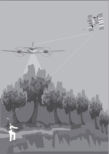 Figure 10.3: GPS applications in forestry
 In the past, aerial photography was the only means of providing information on the shape and location of cut blocks before completing harvesting operations. Such information was often lacking in accuracy. With the use of differential GPS, however, this information can be accurately determined in real time.
GPS has also been a very useful tool for wildlife management and insect infestation. Using its precise positioning capability, GPS can determine the locations of activity centers. These locations can be easily accessed using GPS waypoint navigation (see Section 10.15).
GPS surveying is becoming the preferred method for forest boundary determination. With real-time GPS, a reduction in time and cost for a typical surveying project of up to 75 percent is possible. As discussed in Chapter 9, in case of poor GPS reception under heavy tree canopy, it might be useful to use integrated GPS and LRF systems. Other integrated systems, including GPS/digital barometers and GPS/laser digital videography,...

 TABLE OF CONTENTS