Radar Handbook, Second Edition

David J. Murrow
General Electric Company
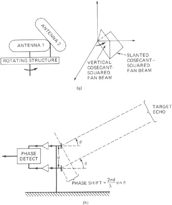
Early radar techniques employed to find target height were classified according to whether or not the earth's surface was used in the measurement. The practice of using the earth's surface for height finding was quite common in early radar because antenna and transmitter technologies were limited to lower radio frequencies and broad elevation beams. The first United States operational shipborne radar, later designated CXAM and developed in 1939 by the U.S. Naval Research Laboratory (NRL), used the range of first detection of a target to estimate its height, based on a knowledge of the shape of the pattern near the horizon due to the primary multipath null. Later a refinement was made as the target traversed the higher-elevation multipath nulls or "fades." This technique, illustrated in Fig. 20.1 a, was extensively employed on early shipborne radars, where advantage could be taken of the highly reflective nature of the sea surface. Of course, the technique was limited in performance by such uncontrollable factors as sea state, atmospheric refraction, target radar cross section, and target maneuvers.1 ,2


