Engineering Surveying, Sixth Edition
With many worked examples and illustrations of tools and techniques, this important text gives readers a clear understanding of fundamentals such as vertical control, distance, angles and position.
Distance is one of the fundamental measurements in surveying. Although frequently measured as a spatial distance (sloping distance) in three-dimensional space, usually it is the horizontal component which is required.
Distance is required in many instances, e.g. to give scale to a network of control points, to fix the position of topographic detail by offsets or polar coordinates, to set out the position of a point in construction work, etc.
The basic methods of measuring distance are, at the present time, by taping or by electromagnetic (or electro-optical) distance measurement, generally designated as EDM. For very rough reconnaissance surveys or approximate estimates pacing may be suitable.
For distances over 5 km, GPS satellite methods, which can measure the vectors between two points accurate to 1 ppm are usually more suitable.
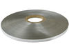
Tapes come in a variety of lengths and materials. For engineering work the lengths are generally 10 m, 30 m, 50 m and 100 m.
Linen or glass fibre tapes may be used for general use, where precision is not a prime consideration. The linen tapes are made from high quality linen, combined with metal fibres to increase their strength. They are sometimes encased in plastic boxes with recessed handles. These tapes are often graduated in 5-mm intervals only.
More precise versions of the above tapes are made of steel and graduated in millimetres.
For high-accuracy work, steel bands mounted in an open frame are used. They are standardized so that they measure...