Civil Engineering Survey Review, 3ed
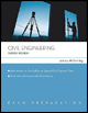
Including many examples and problems with solutions, this detailed guide will help to prepare for the Special Civil Engineer (CE) Exam which is required for all civil engineer examinees.
LEVELING is a process to determine the vertical position of different points below, on, or above the ground.
BENCH MARK is a permanent point of known elevation.
VERTICAL LINE follows the direction of gravity to the center of the earth.
HORIZONTAL LINE is perpendicular to the Vertical Line.
LEVEL SURFACE is a curved surface which has every point perpendicular to the direction of gravity.
LEVEL LINE is a line in a Level Surface, hence is a curved line.
DATUM: Any level surface to which elevations are referred. Mean Sea Level is usually used for a datum.
DIFFERENTIAL LEVELING is the most commonly used leveling method.
An example for differential leveling is illustrated below.
| LEVEL NOTES | ||||
|---|---|---|---|---|
| STATION | BS (+S) | HI | FS ( ?S) | Elevation |
| BM1 | 7.25 | 107.34 | ||
| 114.59 | ||||
| TP1 | 9.66 | 1.07 | 113.52 | |
| 123.18 | ||||
| TP2 | 8.09 | 0.48 | 122.70 | |
| 130.79 | ||||
| BM2 | 10.70 | 120.09 |

Terminology
| BM | Bench Mark |
| TP | Turning Point |
| BS | BackSight (also called plus sight) |
| FS | ForeSight (also called minus sight) |
| HI | Height of the Instrument |
Height of the Instruments:
HI1 = 107.34 + 7.25 = 114.59
HI2 = 114.59 + 9.66 ? 1.07 = 123.18
HI3 = 123.18 ? 0.48 + 8.09 = 130.79
Bench Marks:
BM1 = 107.34
BM2 = 130.79 ? 10.70 = 120.09
The difference in elevation = 120.09 ?

 TABLE OF CONTENTS